- גרסה: V2.0
- גודל הורדה: 31.38 MB
- שוחרר בתאריך: 05-03-2010
- מערכת הפעלה: iOS 8.0 ומעלה
- תאימות:
- מתאים עבור: גילאי 4 ומעלה
- מחיר בחנות: חינם
שתפו אפליקציה זו עם החברים
View Country and World Maps conveniently and easily.
Carry your pocket Atlas wherever you go for a quick reference.
Did you know?
-------------
South Sudan became the world's 195th country following separation from Sudan on 9 July 2011
*** FEATURES ***
- Over 10 Maps
- Quick Map Selection
- Offline maps. No Internet connection is required.
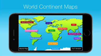
Contains Maps of:
===============
- the World (Political World Map)
- North America
- Central America
- South America
- Europe
- Middle East
- Africa
- Antarctic
- Asia
- Southeast Asia
- Oceania
Users Love Atlas!
5 Star Review *****
Very informative and easy to use.
- Crooner II
5 Star Review *****
Great atlas! I like having the convenience of a world map on my iPhone.
- Med247
5 Star Review *****
I have always been interested in geography and the way countries are constantly changing it's nice to have maps that are current.
- liteOhope
The World in Your Hands.
Try it Today!
הורידו עכשיו את Atlas 2012, אפליקציה לימוד שפותחה במיוחד עבור אייפון ואייפד ע"י Appventions. נשמח לשמוע מכם תגובות, שתפו אותנו בחווית השימוש, שאלות או טיפים שימושיים על Atlas 2012.
צריכים עזרה? נשמח לעזור לכם להשתמש באפליקציית Atlas 2012 באמצעות מדריכי וידאו, עזרה, טריקים ועוד.

