- גרסה: V1.7
- גודל הורדה: 4.19 MB
- שוחרר בתאריך: 09-09-2011
- מערכת הפעלה: iOS 9.0 ומעלה
- תאימות:
- מתאים עבור: גילאי 4 ומעלה
- מחיר בחנות: ₪ 10.90 (במקום 11.90 ש"ח, ירידת מחיר לזמן מוגבל) עודכן ב29 באוקטובר 2017.
שתפו אפליקציה זו עם החברים
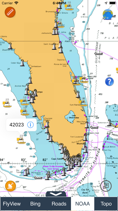
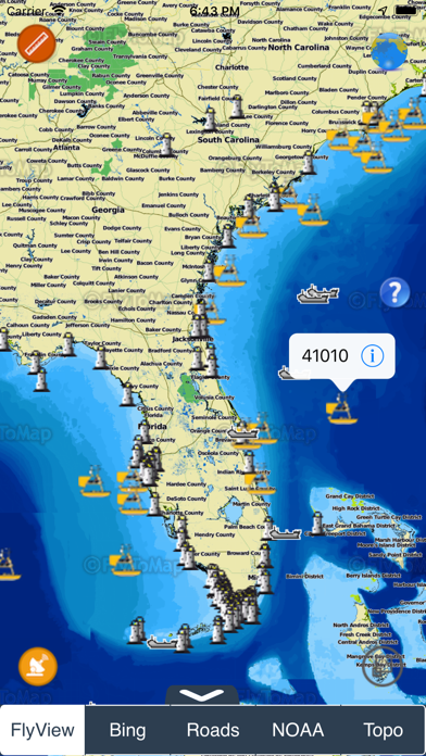
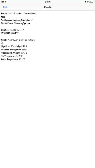
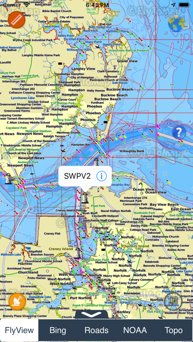
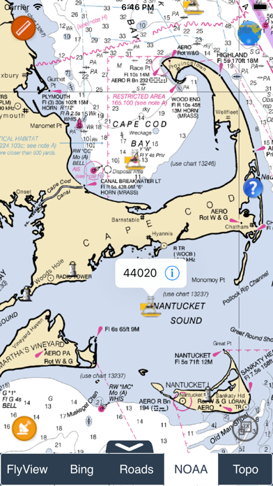
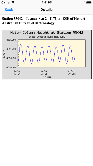
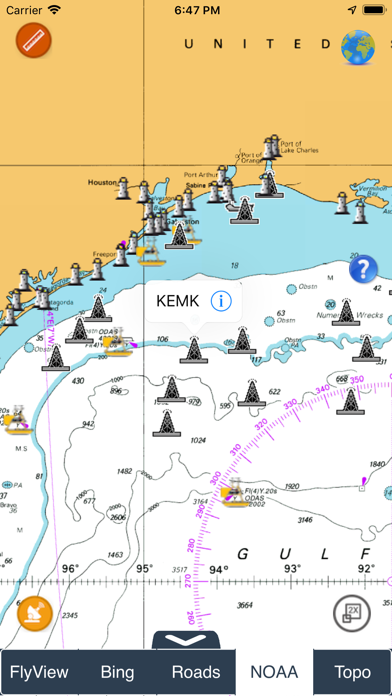
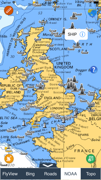
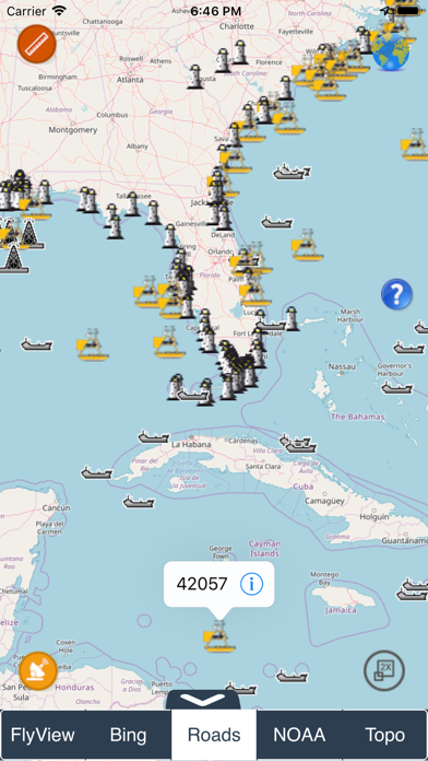
NOAA Buoy data viewer allows you to retrieve info like tides, wave height and period, wind speed and direction, air and water temperature, humidity, dew point, atmospheric pressure, rising and falling indicator, visibility, tsunami and typhoon warnings on the detailed marine chart thanks to viewer.flytomap.com
All stations, buoys and ships are drawn on the world marine map, you can easily search the nearest stations and retrieve all NOAA info.
Just tap and get the info you require.
Advise and info are coming directly from NOAA's National Data Buoy Center.
A must for boaters, sailors, anglers and divers.
Detailed Features:
* View buoys near you
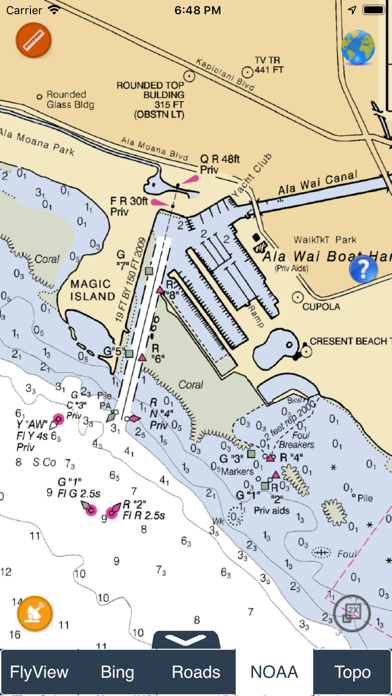
* Use GPS or manually enter your choosen location on a very detailed Marine Map.
* Works on all iPhone, iPod, and iPad versions.
* Detailed live buoy data with access to location specific forecasts.
* Buoys sorted by proximity to your selected location.
* Tide Predictions.
* Moon phases.
**For the buoy locations available on NOAA BUOY app, go here: http://www.ndbc.noaa.gov/
"Continued use of GPS running in the background can dramatically decrease battery life."
הורידו עכשיו את NOAA Buoys Stations and Ships, אפליקציה שפותחה במיוחד עבור אייפון ואייפד ע"י Flytomap. נשמח לשמוע מכם תגובות, שתפו אותנו בחווית השימוש, שאלות או טיפים שימושיים על NOAA Buoys Stations and Ships.
צריכים עזרה? נשמח לעזור לכם להשתמש באפליקציית NOAA Buoys Stations and Ships באמצעות מדריכי וידאו, עזרה, טריקים ועוד.